 –
Mike's books
–
Mike's books
astronauticsnow.com/tt/
Mike's space and rocket videos –
–
Mike's books
Tyuratam Missile Test Range
Baikonur Space Launch Site (Cosmodrome)
M. Gruntman,
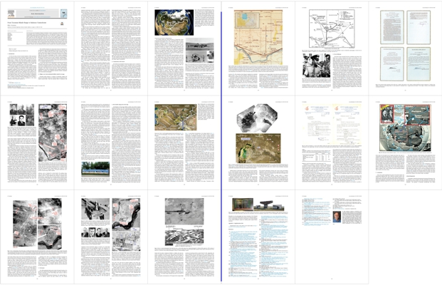
From Tyuratam Missile Range to Baikonur Cosmodrome (pdf),
or at Acta Astronautica
http://dx.doi.org/10.1016/j.actaastro.2018.12.021
Acta Astronautica, vol. 155, pp. 250-366, 2019
(detailed historical account)
Tyuratam Missile Test Range
Baikonur Space Launch Site – Cosmodrome
Nauchno-Issledovatel'skii Ispytatel'nyi Poligon No.5 (NIIP-5)
or Scientific-Research Test Range N0.5
Tours to space launches at Baikonur
It is possible to visit Baikonur as a tourist and attend space launches.
Main tour operators:
Vegitel – http://starcity-tours.com
Mir Corp. – http://mircorp.com
Space Affairs – http://space-affairs.com
Space Adventures – http://spaceadventures.com
Sputnik Explorer Vanguard Astronautics Missile defense Baikonur Tyuratam Saryshagan Rocket equation Rocket espionage U-2 Neil Armstrong USC
Mike's books
–
Mike's space and rocket videos –
Make the world a better place
M. Gruntman, From Tyuratam Missile Range to Baikonur Cosmodrome,
Acta Astronautica, Vol. 155, 250-366, 2019
article pdf (11M)
or http://dx.doi.org/10.1016/j.actaastro.2018.12.021.
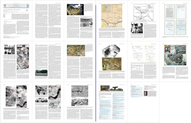
Detailed historical account of establishing Tyuratam/Baikonur, discovery of its location by the United States, and naming Baikonur after Gagarin's flight in 1961 (article abstract and flyer)
From Tyuratam Missile Range to Baikonur Cosmodrome
M. Gruntman, From Tyuratam Missile Range to Baikonur Cosmodrome,
Acta Astronautica, Vol. 155, 250-366, 2019
article pdf (11M)
or http://dx.doi.org/10.1016/j.actaastro.2018.12.021.
Abstract
The Soviet space port in Kazakhstan, Baikonur cosmodrome, occupies a special place in the history of rocketry and spaceflight. The first intercontinental ballistic missile R-7 successfully lifted off there in August 1957 and reached the Kamchatka peninsula six thousand kilometers away. Six weeks later, a modified R-7 placed the first artificial satellite of the planet Earth, Sputnik, into orbit. In 1961, the first cosmonaut Yuri Gagarin began his space journey from the same launch pad. At that time the Soviet Union publicly identified, as a Cold War deception, the secret space port as Baikonur, a small town 300 km away from the real location of the launch site. American government officials had known the precise location of the launch base since 1957 and called it more accurately Tyuratam after the nearby railroad station. Space publications rarely mention the artificial, decoy nature of the name Baikonur. Most of the general public today, particularly younger generations, never heard about Tyuratam. This article describes establishment of the first cosmodrome and its naming Tyuratam and Baikonur. It includes some never published heretofore historic documents and reconnaissance photographs.
Download the full article:
pdf (11M)
or
http://dx.doi.org/10.1016/j.actaastro.2018.12.021
What's in a name?
William Shakespeare, Romeo and Juliet (II, ii)
1. Introduction
In 1961 the Union of Soviet Socialist Republics (USSR) announced to the world for the first time the location and the name of its secret launch site that had sent to space the first satellites and the first cosmonaut Yuri A. Gagarin. The USSR decided to register the historic Gagarin flight as a world record with the International Aeronautical Federation (Fédération Aéronautique Internationale or FAI). The FAI rules required specifying the geographic coordinates of the launch and landing areas of the cosmonaut as part of the record dossier.
The first space launches took place at a test range of intercontinental ballistic missiles (ICBMs). In an ostensible attempt to preserve secrecy of its location and mislead the adversaries, Soviet officials provided geographic coordinates of the launch site, the cosmodrome, that was 300 km downrange trajectories of the launched space vehicles. They also identified a small town there, Baikonur. FAI recorded this inaccurate information for posterity. Mass media made the name of the decoy Baikonur famous and it stuck. The government of Kazakhstan even renamed the missile range residential area Leninsk to Baikonur in 1995. A number of respected reference publications such as world atlases and dictionaries listed erroneous coordinates of the decoy Baikonur as those of historic launches [1].
This Cold War deception was unnecessary because an American U-2 reconnaissance plane had photographed the launch site in early August of 1957. U.S. officials named the missile range Tyuratam after the nearby railroad station and government documents have been calling it that name since then. Publicly, the deception continued as the United States did not reveal its knowledge in order to protect intelligence gathering capabilities. For the Soviet Union, the secrecy from the prying Western eyes was always the way of life. In addition, acknowledging U-2 overflights of Soviet territory would have harmed country's prestige. While some Soviet leaders and military officers knew about the reach of the U-2 program many did not [2-5].
It is not known which Soviet leader made the decision to provide the decoy place and name of the cosmodrome to FAI. Perhaps archival documents will reveal the details in the future. Today, some fragments of the story of finding location of the secret launch base by the United States and its naming by the Soviet Union are scattered in publications. Sometimes, they contain factual inaccuracies. This article describes establishment of the first cosmodrome and its naming Tyuratam and Baikonur. It includes never published heretofore historic documents and reconnaissance photographs.
Download the full article:
pdf (11M)
or
http://dx.doi.org/10.1016/j.actaastro.2018.12.021
2. Poligon—new intercontinental ballistic missile test range
Powerful rockets belong to a category of inherently complex and advanced technologies wherein an isolated creative and gifted inventor cannot succeed alone. Only the concerted effort of numerous well organized professional scientists and engineers can achieve capable practical systems. The USSR was the first to marshal the necessary resources and organize a large-scale development of ballistic missiles [6].
The military-sponsored Jet Propulsion Scientific Research Institute (abbreviated RNII in Russian) employed 400 engineers and technicians in a sprawling complex in Moscow in the early 1930s [6,7]. At that time the Soviet missile program dwarfed the effort of National-Socialist Germany. The latter would later produce the first modern ballistic missile A-4 (V-2). In the same decade of the 1930s political purges set the Soviet rocketry back. The German successes in designing, mass producing, and fielding operational ballistic missiles had demonstrated an extraordinary potential of the new technology. Emerging atomic weapons made long-range missiles especially important for future warfare.
After the end of World War II (WWII) the Soviet Union revitalized its ballistic missile program, beginning with the reproduction of the German A-4. The special decree No. 1017-419 of the USSR Council of Ministers "Matters of the rocket weapons" on May 13, 1946 established the structure of the rocket and space establishment for many years to come [8–10]. Among high priority tasks, the decree called for creation of a special test site, or poligon in Russian (stress on the last syllable, po-li-GON), for the ballistic missile program.
In 1947, the military activated the State Central Test Range N.4 (GTsP N.4) near the settlement Kapustin Yar on the eastern bank of the Volga river 110 km (70 miles) southeast from Stalingrad (Volgograd). General Vasilii I. Voznyuk (1907–1976) would command the test site until 1973. Kapustin Yar, or Kap Yar, as it was commonly called, became the primary proving ground for ballistic missiles in the 1940s and early 1950s. New sites for testing air defense systems and air force weapons (the latter often referred to as Vladimirovka) were established in the adjacent areas. Later, Kap Yar became a space port, a cosmodrome, launching its first satellite, Kosmos 1, into orbit in 1962.
Sergei P. Korolev (1906–1966) directed development of the first Soviet ballistic missiles R-1 (8A11, SS-1, Scunner), R-2 (8Zh38, SS-2, Sibling), and R-3 [11,12]. Vasilii P. Mishin (1917–2001) served as Korolev's key deputy in missile development since mid-1940s and would replace him as chief designer after his death in 1966.
The Kap Yar poligon was adequate for flight tests of these early rockets as well as for development of more capable intermediate range ballistic missiles (IRBM) R-5 (8A62, SS-3, Shyster) also built by Korolev and R-12 (8K63, SS-4, Sandal) being developed by Mikhail K. Yangel (1911–1971) in Yuzhnoe Design Bureau in Dnepropetrovsk, Ukraine [13,14]. The ranges of these missiles did not exceed 2000 km (1250 miles).
On December 4, 1950, the Soviet government authorized a feasibility study of intercontinental missiles "with the range 5000–10000 km and warhead mass 1–10 tonne" [15]. (One tonne is a metric ton or 1000 kg.) Two years later the decree No. 443-213ss of the USSR Council of Ministers "On plan of research and development work on long-range rockets for 1953–1955," signed by Joseph Stalin on February 13, 1953, focused Korolev's work on a two-stage ICBM and a two-stage intercontinental winged (cruise) missile [16]. The ballistic and cruise missiles had to deliver 3000-kg (6600-lb) warheads to a distance of 8000 km (5000 miles) with the accuracy of ±15 km (±9 miles). This program would ultimately lead to Korolev's first intercontinental ballistic missile R-7 (8K71, SS-6, Sapwood) and launch of Sputnik.
One year later a different ministry became responsible for the winged missiles. The design bureaus of Semen A. Lavochkin (1900–1960) and Vladimir M. Myasishchev (1902–1978) took over development of the Burya (Tempest in Russian) and Buran (Blizzard) intercontinental cruise missiles, respectively. Many features of Burya and Buran were not unlike those of the supersonic cruise missile Navaho being built by North American Aviation in the United States [17]. At that time both countries considered such cruise missiles as a possible alternative to intercontinental ballistic missiles.
The existing Kap Yar proving ground was too small for intercontinental weapons. Consequently, on March 17, 1954, the decree of the USSR Council of Ministers No. 447-202 "On measures to provide flight tests of articles 'R' on long range" ordered selection of a new larger test site by January 1, 1955 [18]. At the same time another government decree on May 20, 1954 authorized development of the first ICBM R-7 and made it a top national priority.
Kap Yar commander General Voznyuk headed a survey group evaluating possible areas for the new test site. Safety, security, and ICBM range played a major role in determining location of the poligon [19–21]. In addition, the R-7 radio guidance system required three control posts a few hundred kilometers from the launch site which also influenced selection. The radio posts limited yaw deviations of the missile and kept its trajectory in the desired plane. Inertial guidance would become practical several years later.
On February 4, 1955, six officials representing ministries of defense, middle machine building, defense industry, aviation industry, and radiotechnical industry reported the results of site selection [18]. They noted the impossibility of having both the launch site and the impact area 8000 km (5000 miles) away on Soviet territory. Instead, the report proposed to establish a new missile range in Kazakhstan and the impact area 6200 km (3850 miles) away at the Kamchatka peninsula. The required test launches for the full 8000-km range would be conducted at impact areas farther away in the Pacific Ocean.
A week later on February 12, 1955, the new top-secret special-file decree of the USSR Council of Minister No. 292-181 "On new testing range for the USSR Ministry of Defense" authorized "establishment in 1955–1958 of a scientific-research and testing range of the USSR Ministry of Defense for flight development of articles R-7, Burya, and Buran" [22]. The decree placed the headquarters area of the new range "in the Kzyl-Orda and Karaganda administrative regions of the Kazakh SSR [Soviet Socialist Republic] between [the towns of] Novo-Kazalinsk and Dzhusaly." It designated the impact area for tested "articles" on the Ozernoi peninsula at Kamchatka. Fig. 1 shows the locations of the new missile poligon (Tyuratam) and the Kamchatka impact site, codenamed Kama and later, from 1973, Kura. Also shown are the first ballistic missile proving ground Kap Yar, Semipalatinsk nuclear test site, and missile defense test site at Saryshagan activated in 1956 [5,23].
Fig. 1 (see pdf). Main Soviet missile development test centers Kap Yar (Kapustin Yar), Tyuratam (Baikonur), and Saryshagan are located at similar geographic latitudes. Saryshagan primarily supported development of missile defense and air defense systems. The test site Kama (Kura) at the Kamchatka peninsula served as an impact point for launches of the first Soviet ICBM R-7 (SS-6). The military conducted ICBM trials to the full range with impact areas a couple thousand kilometers farther into the Pacific Ocean. Also shown is the main nuclear weapon test site near Semipalatinsk. Original composite satellite photograph (Landsat, mid-1990s to early 2000s) courtesy of NASA WorldWind; image processing, callouts, USSR border (thick white line), and markings by Mike Gruntman.
The decree also directed the Air Force to conduct the first phase of flight trials of Burya and Buran from the Vladimirovka area at Kap Yar. The first winged missiles did indeed fly there but the government canceled their further development before the tests could be moved to a new larger range in Kazakhstan.
3. Construction in the desert
The wheels of government bureaucracy began to turn. On April 29, 1955, the Central Committee of the Communist Party of the Soviet Union and the USSR Council of Ministers issued a top-secret special-file decree No. 827-497ss "On measures to provide construction of a special test site of the Ministry of Defense of the USSR" [24]. It designated the range "NIIP-5 of the Ministry of Defense of the USSR." Here, NIIP-5 stood for Nauchno-Issledovatel'skii i Ispytatel'nyi Poligon N. 5, or Scientific- Research and Test Range N.5. The decree allocated large territories to the new range, 2900 km2 and 4900 km2 in the Kazakhstan's Kzyl-Orda and Karaganda administrative regions, respectively. The government also provided 4600 km2 for temporary use and additionally assigned 4900 km2 to a NIIP-5 branch in the warhead impact area at Kamchatka.
The decree earmarked resources, established responsibilities of various ministries, and outlined tight schedules for this new gigantic national undertaking. As common for a centrally-planned socialist state, the orders dealt with numerous minute supplies of specific construction materials and even quotas for hiring personnel for general stores and canteens of the range. The decree went into such a detail as creation of one additional position for a technician in the secret service KGB (Committee for State Security) office in Kzyl-Orda to support a new line of protected government communications.
The military tasked the 130th Directorate of Engineering Works (Upravlenie Inzhenernykh Rabot, UIR), or the military unit v/ch 12253, to build the new poligon [25,26]. (The Ministry of Defense assigned identifying numbers to military units, e.g., v/ch 12253, with v/ch standing for voinskaya chast', or a military unit.) In the Soviet Army, UIR directorates played the role of engineering headquarters executing construction projects by assigned to them brigades, regiments, and battalions of construction troops and other specialized engineering units. UIR-130 was located in Tashkent, the capital of Uzbekistan and center of the Turkestan military district. Directorate commander Georgii M. Shubnikov (1903–1965) and chief engineer Alexander Yu. Gruntman (1912–1975) had extensive experience of building installations in vast Soviet Central Asia [21,26].
The planners placed the new missile range headquarters with the main residential area on the bank of the Syr Darya river 3 km south from a small railroad station Tyuratam (sometimes spelled Tyura Tam or Tyura-Tam). A tiny settlement near the tracks consisted of "a small station building, two small brick houses, boarding school, dormitory of the rotating train [locomotive] crews, water tower, and several drymud houses of station workers. There were three trees next to the station building and no other vegetation, with monotonous snow-covered [in March] desert beyond the tracks." [A.Yu. Gruntman, 1970, unpublished; 26].
By the time of the April 1955 decree the engineering corps had already fundamentally transformed the area of the new range from its sleepy desolation (Fig. 2). The first platoon of soldiers, supporting surveyors, arrived in January 1955. Chief engineer of UIR-130 Gruntman followed with his senior officers two months later and the directorate staff transferred to Tyuratam from comfortable Tashkent in May. Brigades and battalions of construction troops were pouring in. Numerous specialized automobile, railroad, communications, piping, and airdrome engineering units also joined them at the location [26,27]. Under harsh climate and in primitive living conditions, construction troops had built in a heroic feat the first launch pad for the R-7 and supporting infrastructure by May 1957 [20,21,28,29].
Fig. 2 (see pdf). Top: local people in the area of the missile range in 1950s. Bottom left: surveyors at work in early days of construction. Bottom right: commemorative stone marking the place of the first building at the headquarters area of the range; it reads: "On May 5, 1955, military builders of unit v/ch 12253 laid the foundation of the first building in town of Leninsk." Photographs: top and bottom left from collection of Col. Yu. V. Bonchkovsky, courtesy of Alexander Yu. Bonchkovsky; bottom right: photo (2016) courtesy of Mike Gruntman.
At the peak of construction in those early days more than 20,000 officers and soldiers were building the missile range [26,30,31]. (Construction personnel would peak again at 50 thousand during the work on the Energia-Buran program in 1980s [32].) Creating a major proving ground in a desolate desert with harsh unforgiving climate provided a valuable experience. The military would soon transfer some engineering units from Tyuratam to construction of other Soviet missile centers at Saryshagan and Plesetsk [26,31].
The General Staff of the Soviet Army activated the new NIIP-5 poligon, v/ch 11284, on June 2, 1955, under its first commander Lt. Gen. Alexei I. Nesterenko (1908–1995). This unit of the strategic rocket forces would be disbanded only in December 2011. In 1958 Maj. Gen. Konstantin V. Gerchik (1918–2001) replaced Nesterenko as the commander. Gerchik was severely injured in a major R-16 (8K64, SS-7, Saddler) ICBM accident on October 24, 1960 that killed more than 90 people at Tyuratam [4,33,34]. The tragedy is often referred to as the "Nedelin catastrophe," after the first commander-in-chief of the strategic rocket forces Marshal Mitrofan I. Nedelin (1902–1960) who perished on the launch pad. Then Maj. Gen. Alexander G. Zakharov (1921–2010) assumed command of NIIP-5 from 1961 to 1965. Fig. 3 shows leading military officers of the rocket forces and construction troops who built the missile range in the early days. In 1960, the Minister of Defense designated June 2 as the "official" day of activation of the range. From that time on, it has been celebrated as the birthday of the cosmodrome.
Fig. 3 (see pdf). Leaders of the rocket and construction units that built the Tyuratam Missile Test Range, the future Baikonur space port, in 1950s and early 1960s: (a,d) first Commander (1955–1958) of NIIP-5 Alexei I. Nesterenko; (b) Commander (1951–1965) of UIR-130 Georgii M. Shubnikov; (c) Chief Engineer (1950–1963) of UIR-130 Alexander Yu. Gruntman; (e) second Commander (1958–1960) of NIIP-5 Konstantin V. Gerchik; (f) third Commander (1961–1965) of NIIP-5 Alexander G. Zakharov. Photographs: (a,f) from collection of Col. Yu. V. Bonchkovsky, courtesy of Alexander Yu. Bonchkovsky; (d,e) courtesy of Valerii A. Menshikov; (b,c) from collection of Mike Gruntman.
Formally and informally, the polygon servicemen were divided into the "builders" and "rocketeers," reporting, respectively, to UIR-130 and NIIP-5. Numerous officers and soldiers of construction units had already been working on buildings, installations, and infrastructure in the spring of 1955. In the summer, the growing number of rocketeers began to arrive to Tyuratam as well. They filled various units of the new NIIP-5. In addition first families of officers and non-commissioned officers and civilian employees also appeared at Tyuratam as primitive living conditions steadily improved and first residential housing appeared.
By the end of 1955, the missile range employed 1900 servicemen of rocket units and more than 660 civilians [29]. Construction troops numbered many thousands at that time. Specialists from industry, engineers, technicians, and fitters would spend weeks and months at Tyuratam on temporary assignments, installing equipment. By 1957, engineers from the design bureau of Korolev and its main contractors had joined NIIP-5 officers in preparation for tests of ballistic missiles.
The location of the new proving ground remained a state secret. The government decree from April 29, 1955, instructed security services to establish a special regime of internal passport control in the areas surrounding the vast NIIP-5 territory [24]. The air traffic corridor connecting central Russia with Tashkent along the Syr Darya river was rerouted 50 km south from the river and away from the proving ground. The decree even tasked the KGB and Ministry of Defense to consider elimination of 2-min stops of passing passenger trains at the Tyuratam station. In those days numerous engineers and technicians have been continuously traveling to and from the range by train as air travel was limited to high level officials and few selected specialists. This reality overruled the fancy of central-planners in Moscow, and trains continued to stop at Tyuratam.
The secret missile range did not have an open name yet, only the cryptic post box numbers. The incoming mail was routed through front addresses, such as Tashkent-90 or Kzyl-Orda-50. The military designated the main residential area with the NIIP-5 and UIR-130 headquarters as Site 10. Other numbered sites referred to numerous technical positions, supporting areas, and living quarters scattered across the vast territory. For example, Site 1 referred to the first launch pad (R-7, Sputnik, Gagarin); Site 2 to the assembly and test building nearby; Site 3 to the liquid oxygen plant; Site 6 to the meteorological post; Site 13 to the cemetery; Site 15 to the first airfield (it does not exist now; replaced in 1964 by today's airport Krainii, Site 15a, a few kilometers to the west); Site 17 to the water pumping facilities on the bank of the Syr- Darya river; Site 41 to the R-16 launch pad of the Nedelin accident in 1960; etc.
A 1966 space reconnaissance photograph (Fig. 4) shows the layout of the central area of the range built up in the 1950s. The main garrison town, Site 10, is 3 km south from the Tyuratam station of the main Turkestan (Orenburg-Tashkent) rail line. By 1957, construction troops had built the first launch pad 24 km (15 miles) to the north; the liquid nitrogen-oxygen plant; and the assembly and test building (Montazhno- Ispytatel'nyi Korpus, or MIK). Engineers assembled the R-7 ICBMs and its space launcher variants horizontally in MIK, tested them, and then brought on a special rail flatcar to the nearby launch installation, Site 1, and erected for launch.
Fig. 4 (see pdf). Satellite photograph of the range areas first developed in the 1950s. The railroad spur and automobile road lead north to the first launch pad (Site 1) from the Tyuratam railroad station on the main Turkestan (Orenburg-Tashkent) rail line. Also shown are the main residential area Site 10; assembly and test building MIK (Site 2); liquid nitrogen-oxygen plant (Site 3); and airport Krainii (Site 15a). Photograph by KH-7 camera (Mission 4033, October 13, 1966) available from the U.S. Geological Survey. Photograph identification, interpretation, and processing by Mike Gruntman.
By the mid-1960s, the range facilities would expand to other launch areas 45 km northwest (e.g., Site 90) and 35 km east-northeast (e.g., Sites 41, 42, 43) from Site 1. Construction troops built connecting automobile and rail roads, water pipelines, communications and power lines, and living quarters across the proving ground that housed servicemen, civilians, and visiting specialists from industry.
The main residential area, Site 10, first received the name Zarya (daybreak or dawn in Russian) on June 2, 1955. It was renamed to a settlement Leninskii on January 29, 1958 and then to a town of Leninsk on June 21, 1966. The name would finally change to Baikonur on December 20, 1995. Today, the billboard at the town central square shows evolution of the name (Fig. 5).
Fig. 5 (see pdf). Billboard at Baikonur central square showing evolution of the town name from (left to right) settlement Zarya (June 2, 1955) to settlement Leninskii (January 29, 1958) to town Leninsk (June 21, 1966) to town Baikonur (December 20, 1995). Photograph (2016) courtesy of Mike Gruntman.
Those serving, working, and living at the range in the 1950s and early 1960s called the entire area simply the poligon or Tyuratam. Actually, people shortened the latter to TT, pronounced teh-TEH. Practically nobody used then the names Zarya and Leninskii for the headquarters area but rather referred to it as the "tenth site" (desyataya ploshchadka) after the site number. From the late 1960s, the town name Leninsk would be commonly used.
Download the full article:
pdf (11M)
or
http://dx.doi.org/10.1016/j.actaastro.2018.12.021
On August 27, 1957, the official Soviet news agency, TASS, announced the first successful ICBM test but did not mention the location or the name of the place of rocket launch [35]. The official announcement of the launch of the first artificial satellite, Sputnik, also did not specify where the rocket started its historic journey to space [36] nor did it identify it for the following satellite launches. On April 12, 1961, TASS reported the first orbital flight of a man, Yuri Gagarin, in space. The news agency described that "the launch of the space multistage rocket was successfully conducted" without mentioning its location [37].
The space launch site and its location in Kazakhstan remained a closely guarded secret from the Soviet people and from the world. However the United States had known its exact location from August 1957 but under a different name.
4. New missile range put on the map
Development of long-range ballistic missiles and nuclear weapons rapidly accelerated in the 1950s, threatening devastating consequences should the Cold War turn into a full-scale military conflict. New technologies allowed no time for preparation for hostilities and mobilization which made an intelligence failure such as a surprise Japanese attack on Pearl Harbor in 1941 unacceptable. Therefore, the United States considered monitoring military developments and posture of the adversary and accurate knowledge of its offensive potential and deployment of forces as a key to avoiding a fatal miscalculation and hence reducing the risk of war. Consequently in 1955 President Dwight D. Eisenhower adopted a national policy of limited peacetime overhead reconnaissance of the "denied areas" [38–43].
The U.S. program of deep-penetration overflights of the Soviet Union began with Missions 2013 and 2014 when the newly-developed high-altitude U-2 reconnaissance planes reached Leningrad and Moscow on July 4 and 5, 1956, respectively [5,38,40,44]. President Eisenhower considered overflights of the USSR as a temporary measure of last resort and kept the number of intrusions down to the absolute minimum. He stopped the program when an S-75 (SA-2, Guideline) antiaircraft missile brought down a U-2 plane piloted by Francis Gary Powers over the Ural mountains on May 1, 1960. This was the last, 24th deep-penetration flight over the USSR.
Ironically in only a few short years a tacit “common law” agreement between the Soviet Union and the United States would tolerate routine photography and electronic and communications intelligence gathering by orbiting satellites. Space reconnaissance eventually made possible verifiable, by national means, arms control and limitations agreements between the superpowers [38,45].
The major growth of ballistic missile and nuclear weapon development programs in Soviet Central Asia could not stay secret for too long. By the mid-1950s U.S. electronic intelligence listening stations in Turkey and Iran had been recording telemetry transmitted by missiles during tests at Kapustin Yar. The intercepts revealed expansion of the activities to new areas to the east but could not determine their precise locations [39,46,47]. On May 6, 1957 President Eisenhower authorized a new series of overflights, operation SOFT TOUCH [48].
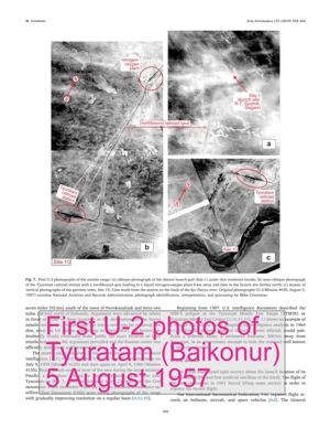
A U-2 aircraft took off from an airfield in Lahore, Pakistan on August 5, 1957. This Mission 4035 searched for a new ballistic missile development center to the east of the Aral Sea. Analysts of the Central Intelligence Agency (CIA) believed that the new proving ground for long-range ballistic missiles should be accessible by railroad. The U-2 plane first reached the capital of Uzbekistan, Tashkent, where the pilot turned on the camera over the city. Then he proceeded northwest to the Syr-Darya river and generally followed the main Turkestan (Tashkent- Orenburg) rail line and the river, heading toward the Aral Sea (Fig. 6). The aircraft flew over a regional center, Kzyl-Orda, then discovered and photographed for the first time the new missile test site, and finally reached Vozrozhdeniya Island in the middle of the Aral Sea [49]. This island was the foremost suspect of housing the main Soviet test site for bacteriological weapons [50]. Then the aircraft flew back, following a rout to the north of the river.
Fig. 6 (see pdf). Flight path of U-2 aircraft, Mission 4035, on August 5, 1957. The airplane took off from Pakistan, turned on its cameras over Tashkent, and proceeded along the Syr-Darya river and the Turkestan (Tashkent-Orenburg) rail line towards the Aral sea. The mission photographed for the first time the launch pad and garrison town of the new missile range near the Tyuratam (TT) railroad station. Original composite satellite photograph (Landsat, mid-1990s to early 2000s) courtesy NASA WorldWind; image processing, callouts, schematic USSR boarder (thick white line), and U-2 flight path by Mike Gruntman.
The official U-2 history noted that "none of the mission planners was certain just where the [missile] range was located, so the U-2 pilot followed the rail lines in the area. As a result, the plane … obtained only oblique photography [of the launch installations]" [51]. Figure 7a shows a fragment of that very first oblique photograph of the distant launch area covered by scattered thin clouds.
Fig. 7 (see pdf). First U-2 photographs of the missile range: (a) oblique photograph of the distant launch pad (Site 1) under thin scattered clouds; (b) near-oblique photograph of the Tyuratam railroad station with a northbound spur leading to a liquid nitrogen-oxygen plant 8 km away and then to the launch site farther north; (c) mosaic of vertical photographs of the garrison town, Site 10, 3 km south from the station on the bank of the Syr-Darya river. Original photographs (U-2 Mission 4035; August 5, 1957) courtesy National Archives and Records Administration; photograph identification, interpretation, and processing by Mike Gruntman.
The chief information officer of the CIA's National Photographic Interpretation Center [43,48] Dino Brugioni (1921–2015) noted that "the huge launch pad was located at the end of a spur extending some fifteen miles [24 km] into the desert from the main rail line" [52]. Another near-oblique photo (Fig. 7b) showed a liquid nitrogen-oxygen plant 8 km from the railroad station. The plane passed directly over and vertically photographed a new garrison town on the bank of the Syr-Darya river, Site 10, with regularly planned streets and houses (Fig. 7c). This was the first photograph of the future town of Leninsk, today's Baikonur.
The month of August 1957 was a very busy time for the Soviet program which rushed development of the Korolev's R-7 ICBM [11]. In a couple years, the range would expand to testing ballistic missiles built by Yangel's Yuzhnoe [13] and then later in 1960s ICBMs and space launchers designed by Vladimir N. Chelomei (1914–1984) [53].
The "one-and-one-half-stage" R-7 ballistic missile (Fig. 8) had one central stage and four side sections, each with its own engine built by the design bureau OKB-456, today's NPO Energomash, of Valentin P. Glushko (1908–1989) [54–56]. Fig. 9 shows the leading ballistic missile and rocket engine designers of 1950s and early 1960s. The kerosene liquid- oxygen RD-107 (8D74) and RD-108 (8D75) engines of the R-7 had specific impulse 250 s at sea level. The fully-fueled 34.2-m tall R-7 weighed 280 tonnes at launch, with the dry weight 27 tonnes. The ICBM carried a 5000-kg warhead section to the projected 8000-km range.
Fig. 8 (see pdf). R-7 ICBM readied for launch at Tyuratam in May–June 1957. The platform stands out as a cliff over the gigantic flame pit beneath. The first ICBM, first artificial satellite, and first cosmonaut were launched from this technical position, Site 1. The installation is operational until this day, sending Soyuz launchers to space. Photo courtesy of Videocosmos. From Ref. [56].
Fig. 9 (see pdf). Chief designers of first ballistic missiles and space launchers tested and launched from the Tyuratam (Baikonur) missile range in 1950s and 1960s: (a) Sergei P. Korolev; (b) Mikhail K. Yangel; and (c) Vladimir N. Chelomei. Also shown (d) is chief designer of rocket engines Valentin P. Glushko. Photographs courtesy of: (a) S.P. Korolev Memorial House-Museum, Moscow; (b,c) Russian Academy of Sciences; (d) NPO Energomash, Khimki.
The first three test launches of the R-7 took place on May 15, June 11, and July 12, 1957. Malfunctions caused termination of the first and third attempts on the 103rd and 33rd seconds of rocket flights, respectively. In the second launch, system failures prevented the missile from leaving the pad.
Finally the fourth launch on August 21, 1957, succeeded, and the R- 7 reached its target area at the Kamchatka Peninsula six thousand kilometers to the east. The simulated warhead did not impact the ground, however, and disintegrated in the atmosphere. The investigation attributed the failure to a likely collision of the warhead with the rocket stage after their separation [56]. On August 27, the official Soviet news agency TASS announced to the world this spectacular success of "a super-long-range intercontinental, multistage ballistic rocket." TASS also pointedly added that "recently, a number of [test] explosions of atomic and thermonuclear (hydrogen) weapons were conducted in the Soviet Union."
The next day after the historic TASS announcement, another U-2 plane, Mission 4058, approached the new missile range from the south, crossed the Syr-Darya river, and photographed vertically first Site 10 and then the launch pad on Site 1. The two-year old headquarters and residential area already showed military barracks, the school, and a number of prefabricated two-family houses (Fig. 10). The town would rapidly grow. The detailed analysis of photographs of the launch pad (Fig. 11, top) allowed reconstruction of its design (sketch in Fig. 11, bottom [4]). The CIA routinely used such sketches instead of original photographs in intelligence documents in order to conceal technical characteristics of its optical reconnaissance systems. Originally designed for 25 launches, the first R-7 pad has sent nearly 500 space vehicles into orbit by the early 1990s [57] and continues to operate today.
Fig. 10 (see pdf). Top: U-2 vertical photograph of the Tyuratam railroad station and garrison town, Site 10, in August 1957. Bottom: two-year old residential area with (a) first UIR-130 headquarters; (b) five Π-letter buildings: barracks of construction troops, officers' dormitory, range telemetry unit; (c) NIIP-5 headquarters; (d) first secondary school (N. 30); (e) area of the future main hospital complex to open in a few years. Original photograph (U-2 Mission 4058; August 26, 1957) courtesy of National Archives and Records Administration. Photograph identification, interpretation, and processing by Mike Gruntman.
Fig. 11 (see pdf). First U-2 vertical photograph of the launch pad, Site 1, at the missile range (top). Original photograph (U-2 Mission 4058; August 26, 1957) courtesy of National Archives and Records Administration. Photograph identification, interpretation, and processing by Mike Gruntman. Bottom: sketch of the launch site (1961) based on U-2 and first Corona satellite photographs; courtesy of Central Intelligence Agency.
More R-7 trials followed in 1957. On September 7, the missile again performed nominally but the warhead disintegrated. (Korolev succeeded in a completely successful ICBM flight on March 29, 1958.) Then, the modified R-7 rocket placed into orbit the first artificial satellite of the Earth, Sputnik, on October 4, 1957, and another much bigger satellite Sputnik-2 with a dog Laika onboard on November 3. The public and world press had not paid much attention to the first ICBM announcement in August. The launches of first satellites in October and November led to the uproar in the United States [58], particularly driven and amplified by internal politics [59].
The U.S. intelligence named the missile test range after a U-2 had discovered its location. Brugioni described many years later that "[d]uring the 1950s, it was the practice in the intelligence community to derive an installation place-name from that of a nearby town. The best available maps of Siberia and Central Asia had been prepared by Mil-Geo, the geographic component of the Wehrmacht [German Armed Forces]" [52]. The U.S. Army captured some those maps at the end of World War II; the Library of Congress holds them today in its collections.
Fig. 12 shows a German WWII topographic map (based on cartographic materials from 1931 to 1939) of the area of the future Soviet launch site. A spur leads straight north from a small Tyuratam station on the main Turkestan rail line into the desert. Brugioni correctly guessed that its destination was a quarry that had existed in the pre-WWII years [52].
Fig. 12 (see pdf). Missile range area (light-blue semitransparent box in top left insert) on the German Wehrmacht WWII topographic map (insert). The map shows the railroad station Tjura-Tam Bf. on the Turkestan rail line. Here Bf. stands for the German word Bahnhof, or station. The white circle with the letter D in the insert points to the mentioned by Brugioni [52] Dzhusaly; another mentioned by him town Novokazalinsk is beyond the boundary of the map to the northwest. A spur heads straight north to an old abandoned sand quarry, the location of the future R-7 launch pad, Site 1. The grid squares on the map are 10 by 10 km. The water tower (Wasserturm) is at the location of the water pumping station, Site 17 (Fig. 10). Original map courtesy of the Library of Congress; interpretation and processing by Mike Gruntman. (For interpretation of the references to colour in this figure legend, the reader is referred to the Web version of this article.)
Chief Engineer of UIR-130 Gruntman explained that "there was a sand quarry at the location of the future launch installation, used during construction of the Turkestan railroad in the early … [20th] century. The sand for railroad tracks was hauled by a [specially built] narrowgauge railroad. After completion of the main railroad and exhausting sand [in the quarry] the narrow-gauge tracks were dismantled. The elevated foundation of the tracks was well preserved during the last fifty years. This was an excellent and the only marker [in the desert]" (A.Yu. Gruntman, 1970, unpublished).
Brugioni described the naming of the range, "Tyuratam is fifty-seven miles [92 km] south of the town of Novokazalinsk and forty-two miles [66 km] north of Dzhusaly. Arguments were advanced by others in favor of either of these locations as the designation for the Soviet missile test center. I argued that the towns were too far removed and that, since the US was so open about its space effort, the Soviets undoubtedly would eventually make public the exact location of their missile test center. My arguments prevailed and the Russian center was officially designated as Tyuratam" [52].
The missile range remained in the crosshairs of the U.S. overhead intelligence [4,43,45,60]. Another U-2 flew over the missile range on July 9, 1959 (Mission 4125) and then again on April 9, 1960 (Mission 4155). Heavy clouds covered most of the area during the latter mission. Finally, a U-2 plane piloted by Powers (Mission 4154) flew over Tyuratam on May 1, 1960 and was shot down 2 h later over the Ural mountains. From December 1960 the Corona photoreconnaissance satellites (first Discoverer XVIII) were taking photographs of the range with gradually improving resolution on a regular basis [4,43,45].
Beginning from 1957, U.S. intelligence documents described the NIIP-5 poligon as the Tyuratam Missile Test Range (TTMTR) or Tyuratam Missile Test Center [4,38,43,45]. Fig. 13 shows an example of a map of the missile range compiled by intelligence analysts in 1964 [61]. After the historic flight of Gagarin, Soviet officials would publicize a different name, a settlement Baikonur 300 km away from Tyuratam, in an unnecessary attempt to hide the real and well known by that time location.
Fig. 13 (see pdf). Map of the Tyuratam Missile Test Center compiled by CIA analysts in 1964, based primarily on space reconnaissance photography. It shows the CIA nomenclature (Complex A, Complex B, etc.) of technical positions on the range. From Ref. [61].
5. FAI dossier
The USSR maintained tight secrecy about the launch location of its historic first ICBM and first artificial satellites of the Earth. The flight of the first cosmonaut in 1961 forced lifting some secrecy in order to register his record flight.
The International Aeronautical Federation, FAI, registers flight records on balloons, aircraft, and space vehicles [62]. The General Conference of FAI in Barcelona, Spain on October 2–10, 1960 began codification of the rules for spaceflight records. The regulations defined, for example, an orbital flight as a flight with a trajectory encircling the axis of the Earth in the coordinate system translationally moving with the Earth but not rotating with respect to the stars [63]. A "particular condition" of the record included a requirement that "the pilot has to send the signed report of his flight to FAI through his [national] Aero Club." In addition, the record registration dossier had to include:
"c) an authenticated account by the agreed upon [sports] commissar indicating the date, the hour, and the place of the lift-off and establishing certain identity of the crew commander and of the vehicle.
d) an authenticated account by the agreed upon [sports] commissar indicating the date, the hour, and the place of the landing and establishing certain identity of the crew commander and of the vehicle."
On April 12, 1961, cosmonaut Yuri Gagarin (Fig. 14) became the first man to fly in space [64–66]. Seven weeks later at the meeting of the FAI commission on sports aeronautics in Paris on May 29–30, 1961, Soviet representative A.I. Tatianchenko submitted "the first dossier of the record in spaceflight" for consideration by the federation and identified the place of landing by cosmonaut Gagarin "near the village of Semenovka, district of Chernovka, Saratov Region" [67].
Fig. 14 (see pdf). First cosmonaut Yuri A. Gagarin at Site 10 in Tyuratam on 12 June 1963, more than two years after his historic spaceflight. Gagarin is in the uniform of an Air Force lieutenant-colonel. Major Andrian Nikolaev, the third Soviet cosmonaut, is on the left. Photo from collection of Mike Gruntman [66].
The submitted dossier included, as required, a report signed by Gagarin and dated April 15, 1961 (Fig. 15, top). The report used the traditional American format of dates (April 12, 1961 and April 15, 1961) and at the same time the British spelling of the words "programme" and "colour." The quotation marks around the spaceship name "VOSTOK" in the first line were inserted after the text was typed, as there were no spaces between them and adjacent words.
Gagarin signed the report as "pilot-cosmonaut of the USSR." A special government decree had established this rank on the previous day, April 14, 1961, and another decree bestowed it on Gagarin [68]. Three months earlier the first group of six cosmonauts had received the ranks of "pilot-cosmonaut of the Air Force" after completing their training.
The Gagarin's report contained no information about location of the launch. However, the submitted dossier included a statement (Fig. 15, bottom left) by Sports Commissar Vladimir A. Plaksin who had witnessed, as required, the launch of the space vehicle and provided the launch coordinates. In the documents, Plaksin's name was spelled as Plaxin, following the French transliteration. The other sports commissar, Ivan G. Borisenko, was responsible for witnessing the landing of the cosmonaut. Both commissars were formally affiliated with the V.P. Chkalov Central Aero Club in Moscow that represented the USSR in FAI [69]. (The statement spelled Chkalov as Tchkalov.)
Fig. 15 (see pdf). Top: report by Pilot-Cosmonaut of the USSR Yuri A. Gagarin, dated April 15, 1961. Bottom: Undated statements by Sports Commissar V.A. Plaksin of the Chkalov Central Aero Club bearing witness to rocket launches of cosmonauts Yuri A. Gagarin (left) and German S. Titov (right). Courtesy of the International Aeronautical Federation.
The Plaksin statement described that "the left-off (sic) of the rocket took place at 9:07 Moscow time. The geographical coordinates of the place of launching are in the latitude of 47° North and the longitude of 65° East." With the adopted later accuracy of 1 min of arc, or 1', the real launch coordinates should have been 45°55' N and 63°21' E. The 1-min coordinate accuracy corresponds to one nautical mile, or 1852 m, in the meridional (north-south) direction and approximately 1300 m in the east-west direction at the latitude of Tyuratam. The map (Fig. 16) shows the reported by Plaksin location, marked L1, and the real launch location Site 1. The missile range residential area Site 10 is at 45°37' N and 63°19' E.
Fig. 16 (see pdf). Composite satellite photographs of the area east from the Aral Sea in 1964 (top) and around 2000 (bottom). L1, L2, and L3 are the reported launch sites (see text and Table 1 (pdf) for details). Dashed line is the Turkestan railroad. Original composite satellite photographs: top – by reconnaissance KH-5 (Argon) camera (Mission 9066A; August 21, 1964), available from the U.S. Geological Survey; bottom – by Landsat (mid-1990s to early 2000s), courtesy of NASA WorldWind. Photograph identification, interpretation, processing, and markings by Mike Gruntman.
The astronautics subcommission of FAI approved the Gagarin flight records at its meeting in Paris on July 18 and 19, 1961. Apparently, the Soviet delegation had also provided the name of the launch location, Baikonur, by that meeting. This explains the specific statement in the congratulatory telegram on the record approval sent by FAI to the president of the V.P. Chkalov Central Aero Club that "the place and time of launch: cosmodrome located in the area of Baikonur at 9 h 07 min Moscow time" [69]. A tiny Baikonur settlement is located at 47°49' N and 66°03' E (northeastern corner in Fig. 16), approximately 85 km to the north from the location L1 reported by Plaksin.
Plaksin's statement in the Gagarin flight dossier had the coordinate uncertainty of one degree which corresponded roughly to 110 km and 80 km in the north-south and east-west directions, respectively. During the meeting of the FAI astronautics subcommittee on July 18–19, 1961, the members apparently asked the Soviet representatives to provide more precise coordinates of the launch site.
The minutes of the next subcommittee meeting on October 12–13, 1961 during the annual General Conference of FAI in Monaco recorded a specific inquiry by the Spanish delegation whether "additional information on flights of commanders Shepard and Gagarin, promised last July, from delegations of the USA and USSR, respectively" was received [70]. (The American Alan Shepard completed his suborbital flight on May 5, 1961.) The Soviet delegation responded that they believed that the complete dossier was in the process of being delivered.
In the fall of 1961, Soviet officials had been “fine-tuning” the launch location story. In addition, a dossier for the record 25-h flight by the second Soviet cosmonaut German Titov on August 6–7, 1961 was also under preparation at that time. (The FAI astronautics commission would approve the spaceflight record of Titov at its meeting on March 10–12, 1962.)
On November 29, 1961, the president of the Chkalov Central Aero Club Alexander F. Koss sent a letter (Fig. 17) to FAI General Director H.R. Gillman with a formal response to the request for additional information on the Gagarin flight. In his letter Koss gave the location of the launch site as "cosmodrom (sic) Baikonur" located at 47°22' N and 65°29' E (marked L2, Fig. 16). The statement of Sports Commissar V.A. Plaksin in the submitted dossier for the record flight of Titov (Fig. 15, bottom right) gave the same geographical latitude 47°22' N but slightly different longitude 65°25' E (marked L3, Fig. 16). The new locations (L2 and L3) were 220 km away from the real launch Site 1.
Fig. 17 (see pdf). Letter by President A. F. Koss of the Chkalov Central Aero Club to FAI General Director H.R. Gillman, dated November 29, 1961, with the additional information on the Gagarin flight. The letter was provided in both English (left) and Russian (right). Courtesy of the International Aeronautical Federation.
The letter of Koss also stated that "the landing [of Gagarin] took place in the cabin of the spaceship" (Fig. 17). In reality, the first cosmonaut left his landing capsule at an altitude of several kilometers and landed independently on a separate parachute.
Table 1 (pdf) summarizes geographic coordinates of reported launch places and their markings L1, L2, and L3 on the map (Fig. 16). It also lists the coordinates of the real launch Site 1, the decoy Baikonur settlement approximately 300 km away, and the main residential area Site 10.
6. Decoy Baikonur
The Soviet Union provided the decoy coordinates and name of the launch site in order to preserve the secrecy of its location. It is not known who personally ordered this action. Given the nature of the highly centralized socialist state and the importance of spaceflight, involving national security and prestige, the decision could have been only made at the very top of the country. For example, it was the Soviet leader Nikita S. Khrushchev himself who signed secret ordinances of the USSR Council of Ministers approving government presents to first cosmonauts after completion of their flights, with such minute items as vacuum cleaners, underwear, and socks [71,72].
The archives may reveal one day the relevant documents. Today, recollections of event participants provide glimpses of what happened.
The Air Force General Nikolai P. Kamanin (1908–1982) oversaw selection and training of Soviet cosmonauts from 1960 to 1971 and commanded their detachment. He kept detailed diaries that were published after the disintegration of the Soviet Union in the 1990s.
Four days before the flight of the first cosmonaut, on April 8, 1961, Kamanin recorded deliberations of the State Commission that approved the flight of Yuri Gagarin [73]. Konstantin N. Rudnev (1911–1980) chaired the proceedings. (Rudnev was Chairman of the State Committee for Defense Technology at the time; in two months he would become Deputy Chairman of the USSR Council of Ministers.) The Commission included, among others, Kamanin; Commander-in-Chief of the Strategic Rocket Forces Marshal Kiril S. Moskalenko (1902–1985); director of the Institute of Applied Mathematics and long-time president, 1961–1975, of the USSR Academy of Sciences Mstislav V. Keldysh (1911–1978); and Sergei P. Korolev.
Keldysh played a particularly important role in the space program. In the secrecy-obsessed society, most Soviet people knew him and Korolev as the enigmatic Glavnyi Teoretik (Chief Theoretician) of space activities and Glavnyi Konstruktor (Chief Designer), respectively, with their true identities revealed only after their deaths [58].
Kamanin described that a closed, members-only session of the State Commission considered whether to "register the [forthcoming Gagarin's] flight as a world record and [allow] access of sports commissars [officials] to the launch site and place of landing." Kamanin wrote that "Marshal Moskalenko and [academician] Keldysh opposed [the proposed registration]. Korolev and I were in favor and Rudnev supported us. The Commission resolved to register the flight as a world record but decided not to reveal the secret data about the poligon [test range] and rocket launcher" [73].
Another commission member, General Kerim A. Kerimov (1917–2003), also recalled that Korolev raised the question of providing the coordinates of the rocket launch in order to register the record flight. Kerimov told Korolev that "it was not a simple question and the answer would be provided after the flight." He wrote that "[f]rom [the authorities in] Moscow I was given the coordinates of a settlement Baikonur, and FAI recorded them as the launch pad" [74].
Recollections of Vladimir D. Yastrebov generally corroborate the description of Kerimov though diverge in some details. Yastrebov served at that time as an orbital mechanics specialist in a military research institute, NII-4, that was the main research center of the strategic rocket forces. (NII-4 is part of a cluster of research and development centers in ballistic missiles and space at Podlipki, 25 km north-northwest from the Moscow downtown [75].)
Yasterbov wrote that he "was personally involved in naming the Tyura-Tam launch site 'Baikonur' so as to disguise its true location. A few days after Gagarin's flight my management sent me to one of the central administrations of the Ministry of Defense to meet with Colonel Kerim A. Kerimov …. Together with a senior officer from his section called Alexei (sic) A. Maximov I was asked to draw up the records of Gagarin's flight in term of range and altitude for registration with the International Aviation Federation in Paris. Preparing the document was easy enough, but we encountered a major hurdle when deciding how to identify the site from which the Vostok launch vehicle had lifted off. Since we were not allowed for security reasons to name Tyura-Tam, we studied the map and chose a ballistically plausible down-range alternative in the form of a small Kazakh settlement called Baikonur. And that is what the cosmodrome has been called ever since" [76].
Alexander A. Maksimov (1923–1990) also mentions the similar justification of "security reasons” [77]. (His correct first name is Alexander, not Alexei, as given by Yastrebov in the quote above.) In his story, Maksimov mixes up, however, the registration of the Gagarin's flight with that of the first "ICBM launch with the United Nations," the latter registration never being required or taking place.
The three-star general Maksimov commanded the Chief Directorate of Space Assets (GUKOS), responsible for military space programs in late 1970s and in 1980s. His recollections [77] suggest that he did not know that U-2 aircraft had flown over the Tyuratam missile range in the late 1950s. Some Soviet officials knew about details of multiple U-2 overflights of the country, particularly Tyuratam, but many did not [2–5]. Incredibly, the latter included some top designers of air defense systems [5]. Everybody, however, was aware of the U-2 plane of Powers brought down by an antiaircraft missile over the Ural mountains in 1960.
While the U.S. government did not advertise its knowledge, leaks did occur and even open sources identified the launch base location. For example, in a story [78] on Polaris-armed submarines in its August 1,1960 issue, the Time magazine showed a map of the USSR with Tyuratam labeled as "Russia's [Cape] Canaveral" (Fig. 18).
Fig. 18 (see pdf). USSR map in Time magazine (August 1, 1960; cover in left insert) showing Tyuratam with the label "Russia's Canaveral" (right insert).
Soviet high-level officials involved in the decision to provide a decoy place for the launch site of Gagarin also knew that space reconnaissance would make impossible the concealment of rocket launch facilities. In particular, the design bureau of Sergei Korolev (today's S.P. Korolev Rocket and Space Corporation "Energia") that prepared and launched Sputnik and cosmonaut Gagarin into orbit, had been working since 1957 on the Soviet photoreconnaissance satellite Zenit-2 [79]. Mstislav Keldysh who according to Kamanin [73] opposed disclosing the true location of the launch site had advocated, together with Korolev, development of Soviet heavy reconnaissance satellites prior to launch of Sputnik in October 1957 [80]. The first launch attempt of Zenit-2 would take place in December 1961, only six months after the flight of Gagarin. Later, Zenit-2 became the first operational military space system in the Soviet Union.
7. Conclusion
Soviet mass media popularized the name of the decoy launch site, cosmodrome Baikonur after 1961. While the national security community in the United States called the missile range Tyuratam in classified settings, the American and international media also identified the launch site as Baikonur. In the final act of the story, the government of Kazakhstan officially changed the town name from Leninsk to Baikonur in 1995.
The name of the decoy caused confusion. Some publications listed the geographic coordinates of the real settlement Baikonur as the coordinates of the launch site at Tyuratam. NASA veteran space mission controller and author James Oberg pointed to multiple cases of erroneous coordinates in respected reference literature such as world atlases and dictionaries [1]. Oberg also called for correcting the official records at FAI. His latter effort went nowhere [81].
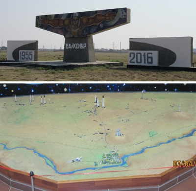
Today, the main residential area of the cosmodrome is Baikonur both in its official name and on the map (Fig. 19). The railroad station is, however, Tyuratam and declassified American intelligence documents preserve that name for history. The U.S. Space Track that catalogs orbiting space objects also lists to this day the Baikonur launch site under the legend TTMTR, spelled out as Tyuratam Missile and Space Complex [82], originally the Tyuratam Missile Test Range. The name Tyuratam remains forever in the memories of the pioneers of the space age and the veterans of the missile range, the polygon.
Fig. 19 (see pdf). Left: departing flights on a monitor at the Vnukovo airport (VKO) in Moscow, with the last line listing Bajkonur (Baikonur). Right: Baikonur monument on a road between the airport Krainii (BXY), former Site 15a, and entrance to the town of Baikonur, former Site 10, in 2016. Photographs courtesy of Mike Gruntman.
Acknowledgements
I would like to thank the International Aeronautical Federation, FAI, for opening to me its archives and help, particularly by former FAI Secretary-General Max Bishop and current Secretary-General Susanne Schoedel. I am grateful to Alexander Bonchkovsky and Valerii Menshikov for the photographs and Jerry Luchansky of the National Archives and Records Administration (NARA) for his help and support. I want to acknowledge the Freedom of Information Act (FOIA) program in the Central Intelligence Agency for making public unique historic materials.
Download the full article:
pdf (11M)
or
http://dx.doi.org/10.1016/j.actaastro.2018.12.021
Brief history of Tyuratam-Baikonur
The Soviet government established Nauchno-Issledovatel'skii
Ispytatel'nyi Poligon N.5 (NIIIP-5), or Scientific-Research
Test Range N.5 (future Tyuratam or Baikonur) by its decree of 12 February 1955.
The U-2
high-altitude reconnaissance plane found and photographed for the
first time the missile test range on 5 August 1957. The location of
the new rocket center was identified on the World War II German
topographical map near Bf., or
Bahnhof (station in German), Tyuratam. Dino A. Brugioni, an
assistant to the chief of the CIA's Photo-Interpretation Division (PID),
named the launching site Tyuratam, following the intelligence
community practice of naming installations after the nearby towns.
The USSR kept the location of the missile range secret.
 Only in 1961
after the launch of the first man to space, Yuri A. Gagarin, the
Soviet Union publicly identified the launch site location as
Baikonur after a small town ... nearly 200 miles (320 km) northeast
away.
Only in 1961
after the launch of the first man to space, Yuri A. Gagarin, the
Soviet Union publicly identified the launch site location as
Baikonur after a small town ... nearly 200 miles (320 km) northeast
away.
See M. Gruntman, Blazing the
Trail. The Early History of Spacecraft and Rocketry, AIAA, 2004
for the historic and technological background
and context. (Many major libraries – more than 500 worldwide –
have the book in their collections.)
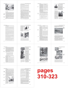
Pages 310–323 of the book (in Chapter 14 "Gateways to Heaven" – history of Cape
Canaveral, Vandenberg, Tyuratam-Baikonur, Plesetsk) describe the history of the
establishment and construction of the Tyuratam Missile Test Range (Baikonur Space Launch Site – Cosmodrome).
 –
Page 312
from Blazing the Trail
–
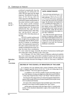
Page 312
from Blazing the Trail
shows parts of the decree of the
USSR Council of Ministers establishing the Tyuratam (Baikonur) Missile Test Range.
 –
Pages 320-321
from Blazing the Trail
–
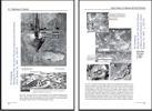
Pages 320-321
from Blazing the Trail
shows a composite satellite
image of the early Tyuratam (Baikonur) launch complex, the cosmodrome,
obtained by Corona on 30 May 1962. Also shown (zoomed in) are the
first space launching pad (first satellite sputnik, first cosmonaut
Gagarin) and the settlement, later called Leninsk.
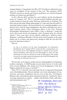 –
Page 133
from Intercept 1961
–
Page 133
from Intercept 1961
discovery of Tyuratam - Baikonur
|
160+ problems with detailed solutions
|
 |
|
|
|
|